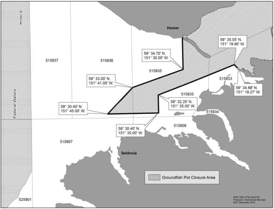
At the Lower Cook Inlet Board of Fisheries meeting in Homer, the Board amended and adopted a proposal to change the groundfish pot closure area boundaries in the Cook Inlet Management Area.
According to a Dec. 5 Alaska Department of Fish and Game press release, the new change goes into effect immediately.
The revised groundfish pot closure area extends west into Kachemak Bay enclosed by the lines east of Gull Island at 59° 34.68’ N. lat., 151° 19.27’ W. long. to the southernmost point of Gull Island at 59° 35.05’ N. lat., 151° 19.90’ W. long., then southwest to 59° 32.20’ N. long., 151° 35.00’ W. long., then south to 59° 30.40’ N. lat., 151° 35.00’ W. long., then west to 59° 30.40’ N. lat., 151° 45.00’ W. long., then northeast to 59° 33.00’ N. lat., 151° 41.00’ W. long., then northeast to 59° 34.70’ N. lat., 151° 30.00’ W. long., then north along that longitude to the point that intersects the mainland.

According to the ADF&G press release, pot fishermen fishing for Pacific cod in the Cook Inlet Area may be asked to carry an observer to monitor bycatch.
The Board of Fisheries meeting was held in Homer from from Nov. 30 to Dec. 3.


